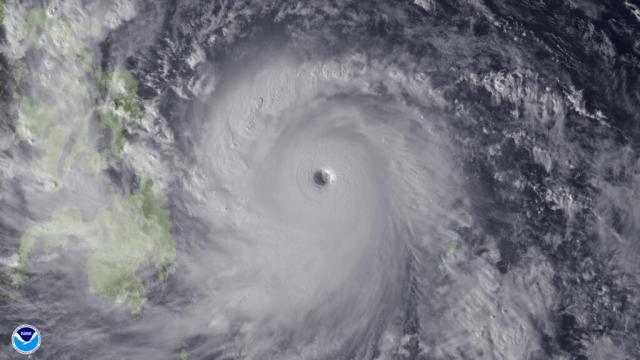
Super typhoon Haiyan is set to make landfall in the Philippines this evening (in the US – Friday morning in the Philippines). Unlike in the US, the Philipinnes do not send hurricane hunter aircraft into tropical cyclones for observations. Instead, the Joint Typhoon Warning Center relies on satellite estimates for wind speed and pressure. As of 3pm EST, the JTWC estimated Haiyan’s maximum sustained winds at 195 mph with gusts up to 235 mph. To put that in perspective, Haiyan’s max winds could decrease by 40 mph (to 155 mph) and it would still be considered a category five hurricane on the Saffir Simpson scale. In other words, this is one of the most powerful tropical cyclones you will ever see.
Keep in mind the Philippines were struck by a 7.2-magnitude earthquake less than one month ago. The quake killed hundreds of people and left hundreds of thousands displaced from their homes. Unfortunately, the forecast track for Haiyan takes the super typhoon very near the epicenter of the quake.
If you’re the praying type, I think the Philippines could use them right about now.

